
 Cart
Cart
|
ITEM #SP136
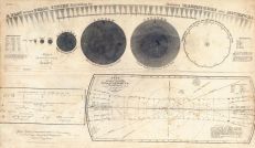
Plan Of the Solar System - Magnitudes and DistanceFrom Atlas Designed to Illustrate the Geography of the Heavens 1835 Published by F. J. Huntington and Co. in 1835 |
 Buy »
Buy »
Map Information
Full Title: Plan Of the Solar System - Magnitudes and Distance
Full Atlas Title: Atlas Designed to Illustrate the Geography of the Heavens 1835
Location 1:
Location 2:
Publish Date: 1835
Publisher: F. J. Huntington and Co.
Number Maps in the Atlas: 12
Map Original Width: 27.69"
Map Original Height: 16.09"
Item Number: SP136
Collection: Historic Map Works Rare Historic Maps Collection
Image Quality: High quality scan of original that is perfect for printed fine-art quality reproduction.
Source Institution:

Souce Media:
Original Document
Souce Media:
Original Document
| This antique map (Plan Of the Solar System - Magnitud...) and atlas (Atlas Designed to Illustrate the Geography of the Heavens 1835) are part of the Historic Map Works, Residential Genealogy™ historical map collection, the largest digital collection of rare, ancient, old, historical, cadastral and antiquarian maps of its type. We currently have over 1,662,956 images available online. You can read about the collection or browse the entire collection. |