
 Cart
Cart
|
ITEM #US52307
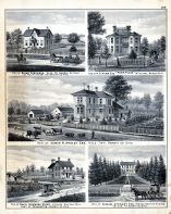
David Longmore Sloan, Samuel Stewart, James R. Ansley Esq., Elias Converse, P.S. Howe, Esq., Park PlaceFrom Hardin County 1879, Ohio Published by Atlas Publishing Company in 1879 |
 Buy this Illustration »
Map Information
Full Title: David Longmore Sloan, Samuel Stewart, James R. Ansley Esq., Elias Converse, P.S. Howe, Esq., Park Place
Full Atlas Title: Hardin County 1879
State: Ohio
Location 1: Unattributed
Location 2: Unattributed
Publish Date: 1879
Publisher: Atlas Publishing Company
Number Maps in the Atlas: 94
Map Original Width: 13.23"
Map Original Height: 16.58"
Item Number: US52307
Collection: Historic Map Works Rare Historic Maps Collection
Image Quality: High quality scan of original that is perfect for printed fine-art quality reproduction.
Source Institution:

Souce Media:
Original Document
Souce Media:
Original Document
| This antique map (David Longmore Sloan, Samuel Stewar...) and atlas (Hardin County 1879) are part of the Historic Map Works, Residential Genealogy™ historical map collection, the largest digital collection of rare, ancient, old, historical, cadastral and antiquarian maps of its type. We currently have over 1,662,956 images available online. You can read about the collection or browse the entire collection. |