
 Cart
CartLocal Township Maps
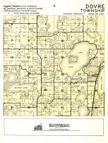
Local township maps are an informational resource that are helpful when researching the history of an area, navigating your way around an unfamiliar area or find areas with special designation. While paper maps aren't utilized as much as they were before the technical revolution, they are readily available in digital forms. Many organizations have taken historic and current maps and have transformed them into digital images. These are available for viewing and purchasing online.
Browse Our Local Township MapsHistorical Significance
The historical significance of many local township maps is unparalleled. Maps date back to the beginning of most settlements. They will outline which settlers took possession of certain areas. Many of these properties have been passed down in these families. Maps recorded when property changed ownership or when parcels were divided up.
When a community decides to restore historical areas and buildings, these maps are invaluable. Combined with old photos of towns, historical maps help restorers know where buildings were located. Since buildings are moved over the years, it is important to check the original location on vintage maps before beginning any restoration project. These maps will also help to establish ownership of any historic area that is being considered for renovation.
Navigational Significance
When traveling to an area that you're not familiar with, it is important to have a map of the area available. Since most local township maps are updated frequently, they are useful in navigating your way through back roads as opposed to the main routes through an area. Using smaller back roads will often save time spent traveling. It is a great way to avoid overcrowded main roads and traffic.
Since the introduction of the interstate system of roads, many smaller townships now go unnoticed by many people when traveling. Interesting sights and fabulous landscape are often missed when travelers stick with main roads. Using local maps is not only a way to navigate through unknown areas; it helps to make discoveries along the way.
Specially Designated Areas
Local maps help to locate areas of special interest. Visitors that are looking for a picnic or recreation area can find those areas on a local map. Wildlife refuges are also noted on these maps as well as state game lands. This differentiation is very important to hunters that travel to different areas to hunt. Often, it is easier for a hunter or hiker to carry a light paper map than to have to deal with an electronic navigational device.
Historic areas are also outlined on local maps. Visitors wanting to see historic sites can utilize these maps to show where they are located. Adventurous visitors can use maps to find hiking and biking trails. If they are traveling with a boat, these maps will help them find a marina and navigate the local lakes and rivers.
Although many navigational devices are now available, paper maps are still a valuable source of information. From learning the history of an area to navigating the present day roads, local township maps are a resource that no traveler or researcher should be without.